

What Happens When a Drone Scratches a Tesla? Essential Insurance & Risk Protection for Real Estate Media
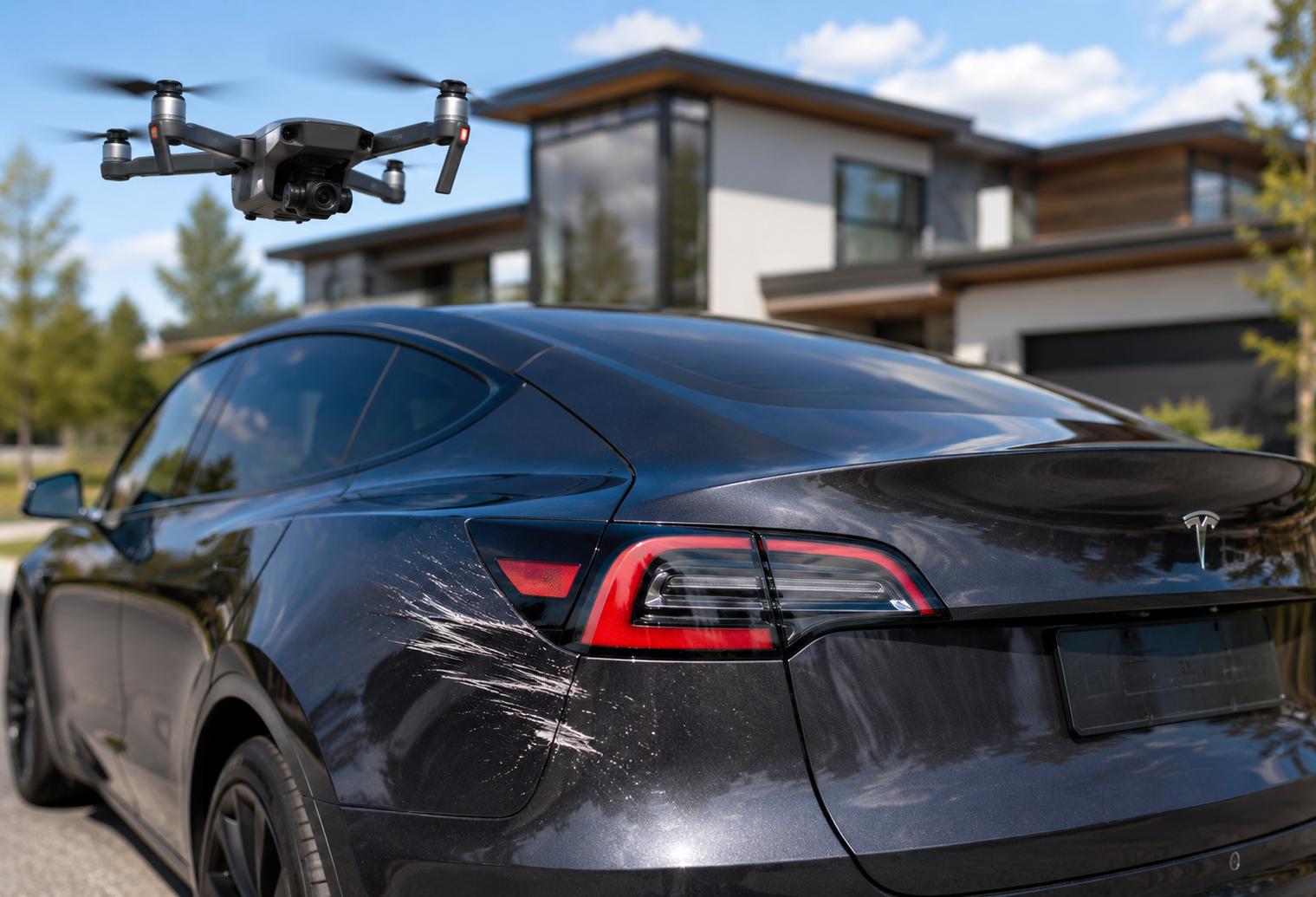
A real estate media shoot can involve more than cameras, listings, and good weather. Around St Cloud, a drone may be operating near parked vehicles, neighboring homes, landscaping, agents, sellers, and other valuable property, which means even a small flight mistake can create a surprisingly expensive problem.
If a drone clips a Tesla, scratches another vehicle, damages siding, or causes another type of property loss, the important question becomes less about the drone itself and more about responsibility, documentation, insurance, and how the operator prepared for the risk.
Quick answer: If a commercial real estate drone damages a Tesla or other property, the operator may be responsible for the resulting repair costs depending on the circumstances. Appropriate aviation liability insurance can provide protection for covered third-party property damage, subject to the policy’s terms, exclusions, deductibles, and limits. Minnesota also imposes insurance and licensing requirements on applicable commercial aircraft operations, making insurance an operational issue rather than simply an optional extra.
What local real estate professionals should know
-
A small scratch can still lead to a professional repair claim, especially when the damaged property is a newer or higher-value vehicle.
-
Commercial drone work in Minnesota falls under rules that are different from purely recreational flying.
-
Properties near St. Cloud Regional Airport can involve controlled-airspace considerations that should be addressed before a flight.
-
Liability coverage should be reviewed for aviation-specific risks instead of assuming a general business policy automatically covers drone incidents.
-
Agents, homeowners, and media professionals can reduce risk by keeping vehicles, people, and unnecessary obstacles away from planned takeoff, landing, and flight areas.
Why Does Drone Insurance Matter for Real Estate Media in St Cloud?
Drone insurance matters for real estate media in St Cloud because a commercial flight can expose an operator to third-party property damage and bodily-injury risk while working around valuable homes, vehicles, and people. Minnesota also has specific requirements affecting commercial aircraft operators, so proper risk protection should be considered before the drone ever leaves the ground.
Real estate flights may occur over driveways in Sartell, larger lots outside Sauk Rapids, commercial properties in Waite Park, or residential listings throughout Stearns, Benton, and Sherburne counties. Every property creates a different operating environment.
A parked Tesla is only one example. Other exposures can include windows, roofs, gutters, siding, landscaping, outdoor furniture, neighboring property, and vehicles belonging to buyers attending a showing.
PixNevel approaches real estate media in the St Cloud area with the understanding that aerial photography is not only about getting an attractive angle. From here, we also have to consider the people, property, airspace, and operating conditions surrounding every flight.
What Do Minnesota Rules Say About Commercial Drone Risk?
Minnesota treats compensated aerial photography as a commercial aircraft operation, and applicable commercial operators must meet state licensing and insurance requirements. Minnesota rules specifically include aerial photography within the definition of commercial operations and require insurance contracts for aircraft used by operators subject to the licensing provisions.
Minnesota Statutes also require liability insurance for aircraft registered or based in the state, with protection addressing injury and property damage. Current registration provisions include minimum insurance standards that aircraft owners must document when required.
Federal rules add another layer. The FAA’s Part 107 framework governs many commercial small-drone operations and requires pilots to operate safely around people, property, and other aircraft. An incident involving at least $500 in property damage, excluding damage to the drone itself, generally triggers FAA accident-reporting requirements within 10 days.
What Happens If a Drone Actually Scratches a Tesla?
If a drone scratches a Tesla, the first priorities are to stop the operation safely, document what happened, notify the property owner, and follow the applicable insurance claim process. The actual financial responsibility will depend on the facts of the incident and the terms of any insurance coverage involved.
The damage should not simply be dismissed because it appears cosmetic. Tesla states that collision repairs are intended to restore vehicle safety, systems performance, fit, and appearance, and it maintains a network of approved collision repair facilities.
A responsible response can include photographing the damage, recording the time and location, preserving flight information, identifying witnesses, and contacting the applicable insurer promptly.
Trying to privately estimate the cost of a scratch before a qualified repair professional inspects it can create unnecessary confusion.
What Warning Signs Suggest a Real Estate Drone Flight Has Higher Risk?
A higher-risk real estate drone flight usually includes tight spaces, nearby vehicles, people, obstacles, difficult weather, or airspace restrictions that reduce the margin for error. Around Central Minnesota properties, several conditions should encourage a more conservative flight plan.
Watch for:
-
Vehicles parked close to the intended launch or landing location.
-
Buyers, sellers, contractors, children, or neighbors moving through the property.
-
Mature trees and branches surrounding the house.
-
Power lines, poles, antennas, or communication equipment.
-
Narrow spaces between neighboring homes.
-
Gusty winds or rapidly changing weather.
-
Snowbanks, ice, or uneven winter launch areas.
-
Properties located near St. Cloud Regional Airport or other controlled airspace.
A good aerial image is never worth forcing an unsafe flight.
When Should a Drone Operator Change or Cancel the Flight?
A drone operator should change, postpone, or cancel a flight when people, property, weather, visibility, or airspace conditions prevent the operation from being completed safely and legally. FAA guidance requires remote pilots to avoid careless or reckless operations and to consider hazards to people and property if control of the aircraft is lost.
That threshold matters locally. A calm morning near the Mississippi River may provide a completely different operating environment than an afternoon with strong winds between buildings. Winter conditions can add slippery surfaces, cold-weather battery considerations, and snow-covered obstacles.
Around St Cloud, another factor is airport proximity. Controlled-airspace operations may require authorization, and the St. Cloud Regional Airport directs drone operators to review applicable airspace restrictions before flying.
What Common Situations Increase the Chance of Property Damage?
The most common property-damage risks come from unnecessary proximity, poor launch locations, changing weather, obstacles, and pressure to capture a particular shot despite limited operating space. Real estate media often takes place in environments where expensive property sits only a few feet from the intended flight path.
A driveway crowded with vehicles leaves less room for takeoff and landing. Trees common throughout established neighborhoods can interfere with otherwise simple orbit shots. Utility lines can be difficult to see from certain angles. Wind around larger commercial buildings in Waite Park can also behave differently than wind across an open lot.
The safer option is often a different angle, a different launch point, or no flight at all.
How Can Agents and Property Owners Reduce Drone Risk Before a Shoot?
Agents and property owners can reduce drone risk by clearing the immediate flight area, limiting unnecessary foot traffic, identifying obstacles, and giving the media professional enough flexibility to choose safe aerial positions. A few minutes of preparation can remove many preventable hazards.
Whenever practical:
-
Move vehicles away from likely takeoff and landing areas.
-
Keep garage doors closed unless they are intentionally part of the shoot.
-
Let the operator know about overhead wires or less-visible obstacles.
-
Avoid scheduling overlapping exterior work during aerial photography.
-
Keep pets and children away from the operating area.
-
Do not pressure the pilot to fly through trees, under structures, or unnecessarily close to property.
-
Allow weather-related rescheduling when conditions are unsafe.
DIY drone flying should also stop when the flight becomes commercial. Minnesota specifically identifies compensated aerial photography as a commercial operation subject to state requirements.
What Results Should Clients Expect From Professional Risk Management?
Professional drone risk management should reduce unnecessary exposure, create clearer procedures when something goes wrong, and help keep aerial photography predictable for agents and property owners. It cannot guarantee that an incident will never occur, but it can reduce avoidable risks and improve the response if one does.
That means thinking about the entire property rather than only the camera angle.
For a listing in Sartell, the safest route may avoid a neighboring driveway. In Sauk Rapids, tall trees may change the flight path. Near the St. Cloud Regional Airport, airspace may affect when or how the drone can operate.
The goal is controlled, intentional aerial media rather than getting every possible shot at any cost.
What Mistakes Create Unnecessary Drone Liability?
The biggest drone liability mistakes involve assuming nothing will go wrong, treating insurance as interchangeable, and allowing the desired photo to override operating conditions. Better risk management starts before arriving at the property.
Mistake: Assuming a standard business policy automatically covers drone accidents.
Consequence: An incident may reveal exclusions or coverage gaps.
Better approach: Verify aviation-related coverage and understand policy limits and exclusions.
Mistake: Launching beside expensive vehicles because it saves time.
Consequence: A loss of control can immediately become a property-damage claim.
Better approach: Create separation whenever the property allows it.
Mistake: Flying despite worsening wind.
Consequence: Control margins decrease around trees, structures, and neighboring property.
Better approach: Change the shot or reschedule the aerial portion.
What Is a Common Local Drone-Damage Scenario?
A common local scenario is a listing where the driveway provides the easiest launch area but several vehicles remain parked near the house. This is a hypothetical example, not a PixNevel case study.
Imagine a photographer preparing aerial media for a home in Stearns County. A Tesla is parked near the garage, trees restrict one side of the property, and wind makes the original launch location less comfortable than expected.
The safest response is not to squeeze the drone through the available space. Moving the launch point, asking whether the vehicle can be relocated, modifying the shot list, or postponing the flight can all reduce exposure.
What Real Estate Media Services Benefit From Strong Drone Risk Practices?
Aerial listing photography, exterior media, property overview images, and other drone-supported real estate services all benefit from deliberate flight planning and appropriate risk protection. For agents and property owners, the purpose is straightforward: create useful marketing media without introducing unnecessary risk around the property.
Our approach is to treat aerial work as part of the overall property-media plan, not as a separate stunt performed simply because a drone is available.
Should You Use DIY Drone Photography or a Commercial Media Provider?
A commercial media provider is generally the better option when drone imagery is being created for a property listing because compensated aerial photography involves aviation rules, operating judgment, airspace considerations, and commercial risk. DIY flying may look simple, but using a drone for business purposes creates responsibilities beyond knowing how to control it.
For real estate professionals, the comparison is less about whether someone owns a drone and more about whether the flight is being planned as a commercial operation.
What Areas Does PixNevel Serve Around St Cloud?
PixNevel supports real estate media needs in St Cloud and the surrounding Central Minnesota market. Nearby communities commonly associated with the local market include Waite Park, Sartell, and Sauk Rapids, with properties extending across Stearns County and neighboring Benton and Sherburne counties.
Specific service availability can depend on the property and requested media.
What Can Happen If Drone Risk Is Ignored?
Ignoring drone risk can turn a routine real estate shoot into property damage, schedule disruption, an insurance matter, or a regulatory issue. The potential cost is not limited to replacing the drone, since another person’s vehicle, home, or other property can be considerably more valuable.
The better strategy is prevention. Clear operating space, appropriate insurance, responsible flight decisions, and proper airspace planning all help reduce avoidable exposure.
FAQ
Is drone insurance required for commercial real estate photography in Minnesota?
Minnesota imposes insurance requirements on applicable commercial aircraft operations, including compensated aerial photography. State rules define aerial photography as a commercial operation and require insurance for aircraft used under applicable commercial licensing provisions. Operators should verify the exact registration, licensing, endorsement, and insurance requirements that apply to their operation.
What if a drone damages a car during a St Cloud real estate shoot?
The incident should be documented and reported through the appropriate insurance process rather than handled casually. Responsibility and payment will depend on the circumstances and policy terms. If property damage reaches the FAA’s reporting threshold, federal accident-reporting rules may also apply.
Does a general liability policy automatically cover drone damage?
Not necessarily, because insurance policies can contain aviation exclusions or other limitations. Operators should confirm that the coverage being relied upon actually applies to drone operations and third-party property damage. Policy language, deductibles, limits, covered aircraft, and exclusions should be reviewed with the insurer or insurance professional.
Can drones be flown near St. Cloud Regional Airport?
Drone operations near St. Cloud Regional Airport may be possible, but controlled-airspace authorization can be required depending on the location and flight. The FAA requires authorization for Part 107 operations in applicable controlled airspace, so operators should review airspace before arriving at the property.
Should vehicles be moved before drone photography in St Cloud?
Moving vehicles away from the drone’s operating area can reduce unnecessary property-damage exposure when it is practical to do so. It is especially useful when a driveway is being considered as a launch or landing point or when vehicles sit close to trees, buildings, or other obstacles.
Can wind cancel aerial real estate photography in Central Minnesota?
Yes, unsafe wind or rapidly changing conditions can justify postponing the aerial portion of a real estate shoot. Conditions can vary significantly between an open property and a tighter residential setting with mature trees or nearby structures. The flight should be based on safe operating conditions, not the listing schedule alone.
Does using a small drone eliminate property-damage risk?
No, a smaller drone can still damage paint, glass, siding, landscaping, or other property during an impact. Size may affect the severity of an incident, but it does not eliminate responsibility. Maintaining adequate separation from vehicles and structures remains one of the simplest ways to reduce exposure.
Why should St Cloud real estate agents care about a photographer’s drone practices?
Agents should care because an avoidable drone incident can interrupt a listing shoot and create problems for sellers, buyers, neighbors, and other property owners. Responsible aerial operations help protect the property while allowing agents to use valuable overhead perspectives when conditions and airspace permit.
Protect the Property While Capturing the View
Strong real estate media should showcase a St Cloud property without creating unnecessary risk around it. Thoughtful flight planning, appropriate insurance, safe operating space, and respect for changing conditions help make aerial photography a useful part of the listing process.
Create Aerial Media With Property Protection in Mind
We focus on helping Central Minnesota listings get the visual coverage they need while treating the property and surrounding environment with care.